Thursday, July 17, 2008

JULY 16TH

We say goodbye to the Tetons today and travel to Idaho.The area from Idaho Fall to Arco is VERY arid.(Read dry,no real vegetation,dust storms!). We stopped at theEBR-I...the worlds first nuclear power plant.(1). This is where electricity was first produced using atomic energy.(4)The project involved a Breeder Reactor. (I have the brochure for anyone wanting accurate info!). Out side they have the remnants of a program involving the development of a nuclear powered fighter plane(2). That didn't quite work out, too dangerous in a crash!

Yep,that is Jan at the control panel. I am about to push the SKRAM button, which when the facility was is operation stopped EVERYTHING!(3)

Took care of some car maintenance (oil change) in Arco, Idaho. Set up camp and did laundry and enjoyed the moon rise and pleasant temperatures.(5)


JULY 15TH

Last night we went out for a twilight ride hoping to see some wildlife. We were treated to a beautiful sunset and a moose!(1) This morning..Good Morning Tetons!!(2) We took a ranger guided hike to Inspiration Point (72oo feet elevation!).(3) We viewed Hidden Falls(4) on the way to the Point. Afterwards we decided to hike a bit farther into the canyon for the views and we encountered a National Park Service work crew consisting of 2 men and 3 pack horses.(5) Awesome!

Totally exhausted and dehydrated (despite taking plenty of water with us), we went in to Moose, Wyoming for dinner and ice cream (Huckleberry for Mark and Moosetracks for Jan!)


JULY 14TH

Today was Old Faithful Day!(1) We showed up at the geyser right after and eruption,so had some time to kill. To occupy us we took a tour of the historic Old Faithful Inn. The clock hanging on the chimney is an antique. It is not currently operational.(2) This is a beautiful old building built out of local trees and completed in 1 years time. There is a really cool indoor tree house in the upper story.(3) We viewed the 12:15 eruption from the balcony of the Inn.(4)

It's hard to beat Old Faithful,but down the road to Grand Teton National Park!(5)


Tuesday, July 15, 2008

JULY 13TH

Thanks to Catie for stepping in and helping out!

Don't forget to click the photos to enlarge!

Also, at the bottom of the page on the far right is a prompt for older post, did you see Mark in the kayak in Ohio?!

We arrived in Gardiner,Montana Saturday evening. Took a walk through town (a short walk for a short town!). Did come across a performance taking place outside the gate of Yellowstone. A guy, a guitar and a song (or 2). Sat and enjoyed a few tunes before retiring for the night.

Sunday am we entered Yellowstone National Park through the Roosevelt Arch. We made a stop at the Mammoth Hot Springs Visitor Center to pick up maps and general info. There were elk grazing on the lawn!

We headed toward the Tower Fall area. Thought we might see more wildlife off the beaten path, so we went down the Blacktail Plateau Drive. No wildlife,but lots of wildflowers. (and even more dust!)

Ready for a little walking we started up the Blacktail walking trail. Not 100 yards up the trail was a pronghorn antelope!

Farther down the road we entered what is called the"Grand Canyon of the Yellowstone". Certainly not as large as the Grand Canyon but beautiful in its own right. The "Canyon" is the home to the Upper and Lower Falls of the Yellowstone River. We had a little traffic problem on the way to the Upper Falls...Took a few minutes to get around Mr. Buffalo. Loved every minute of that traffic jam!

Because of heavier than normal snowfall this year and a late spring snowfall, the melt water in the Yellowstone River is of much higher volume making the waterfalls even more spectacular!

Our last stop of the day was the Norris Geyser Basin. Since is was a fairly warm day the geysers were not as showy as when the air temperature is lower.


Greetings from Yellowstone!

Happy Tuesday everyone, Catie here..

I’m doing a bit of guest blogging, as my parents are currently in the wilds of Tetons National Park. I wanted share the photo below with you. If you look very closely you will see two small figures in khaki and white stationed directly in front of Old Faithful. It’s our very own Jan and Mark! (click photo for larger image)

As soon as the folks get back online I am sure that we will be delighted with further photos. Until then, enjoy!

Catie


Friday, July 11, 2008

JULY 10TH and 11TH


July 10th

We drove into a huge thunderstorm just 50 miles out of Sauk Center. Our weather radio was going crazy with warnings! We had to pull into the emergency lane and let the worst of it pass over us. Even the semis were pulling over! Once the storm subsided we continued on our way.

After traveling over miles of prairie, across Minnesota and through Fargo and Bismark , North Dakota, we finally arrived at Medora, North Dakota. This will be our home while we visit Theodore Roosevelt Natl Park.

It is a good thing that we have electric hookups here, because it is 100 degrees outside. The AC is going on NOW!!

July 11th

After a trip to Theodore Roosevelt National Park Visitors Center to get basic information (maps!),we set off on a 36 mile scenic loop drive. We are in the North Dakota badlands. It is amazing how erosion of rocks can be such a work of art! We also saw bison,wild horses, wild turkey, and lots and lots of prairie dogs. We also startled a snake that startled us right back!

Off to Yellowstone tomorrow!


JULY 9TH

Today was one of the necessary "mileage days".We left the Northwoods and traveled 350 miles to Sauk Center, Minnesota. This is the hometown of writer Sinclair Lewis (Main Street, Babbitt). We camped at the Sinclair Lewis campground. Our evening entertainment was provided by a brass quintet that was performing in the band shell in the adjoining park. Beautiful music, beautiful surroundings and a beautiful sunset.


JULY 8TH

We are on the Gunflint Trail. It is a 63 mile scenic route that runs north - west from Grand Maris, Minnesota to Boundary Waters Canoe Area. This is what is often referred to as the North Woods. Today was too windy and rainy to canoe or hike, so we car toured instead. We drove to Trails End, the terminus of the Gunflint Trail. They are recovering from 3 fires in 3 years. The virgin forest is gone, but rapid regrowth is taking place.

Thought you might enjoy the Minnesota humor on the billboard!


Tuesday, July 8, 2008

July 7 and 8th

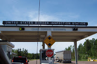
We crossed back into the US this afternoon. Another inspection!! We passed again.

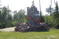
We are now on the Gunflint trail in Minnesota. Took it easy after arrival and just set up camp and sit and read until dinner time. Went down the road to a lodge and had a great dinner with a nice view of Gunflint Lake. We plan to do some hiking tomorrow, weather permitting. The only real problem we have encountered so far on this trip is the national bird of Canada and the state bird of Minnesota..mosquitoes! Thank goodness for Deep Woods Off!!

Last night just before we turned in for the night we went out to check out the stars. Sunset here is around 10:30pm. The stars were brilliant! There is virtually no light pollution here so the starlight is almost blinding. While we were stargazing a small fox crossed our campsite. THIS IS CAMPING!


July 5th and 6th

We drove 350 miles across the top of Lake Superior to Sleeping Giant Provincial Park on Saturday. We saw our first moose of the trip today. She was across a pond and we were traveling at 50 miles an hour... so no picture! The name Sleeping Giant describes a group of mountains that look like a giant sleeping on his back.

The campground was packed on Saturday(we think the entire population of Thunder Bay,Ontario was there!) Most everyone left Sunday and it was a kinder and gentler place!
We hiked the Middleburn Trail to Findlay Beach and saw a porcupine on the way. There are lots of deer here too.

The campground that we stayed in was on Marie Louse Lake. Marie Louise was Mark's moms name. What a coincidence!


JULY 3rd and 4th

Thursday morning July 3rd found us crossing the Mackinac Bridge into the Upper Peninsula of Michigan. We continued North to Sault St.Marie and made our border crossing in to Canada. They required a complete inspection of the truck and trailer. We must have looked like "sketchy"characters!

That completed, we were on our way to Lake Superior Provincial Park on the east side of Lake Superior and the Agawa Bay campground. Our campsite was just feet away from the shoreline, giving us a beautiful view of the ocean-like lake.(Lake Superior is 350 miles long and 150 miles wide). We had amazing sunsets!

We had a breathtaking hike on the Sand River Trail. There were a series of waterfalls and cascades over a 3 mile area.

We also hiked to the edge of the lake and viewed the Agawa pictographs, as well as hiking to Orphan Lake with views of Lake Superior beyond.

We did miss having fireworks on the Fourth, but would not have traded the sites we saw.